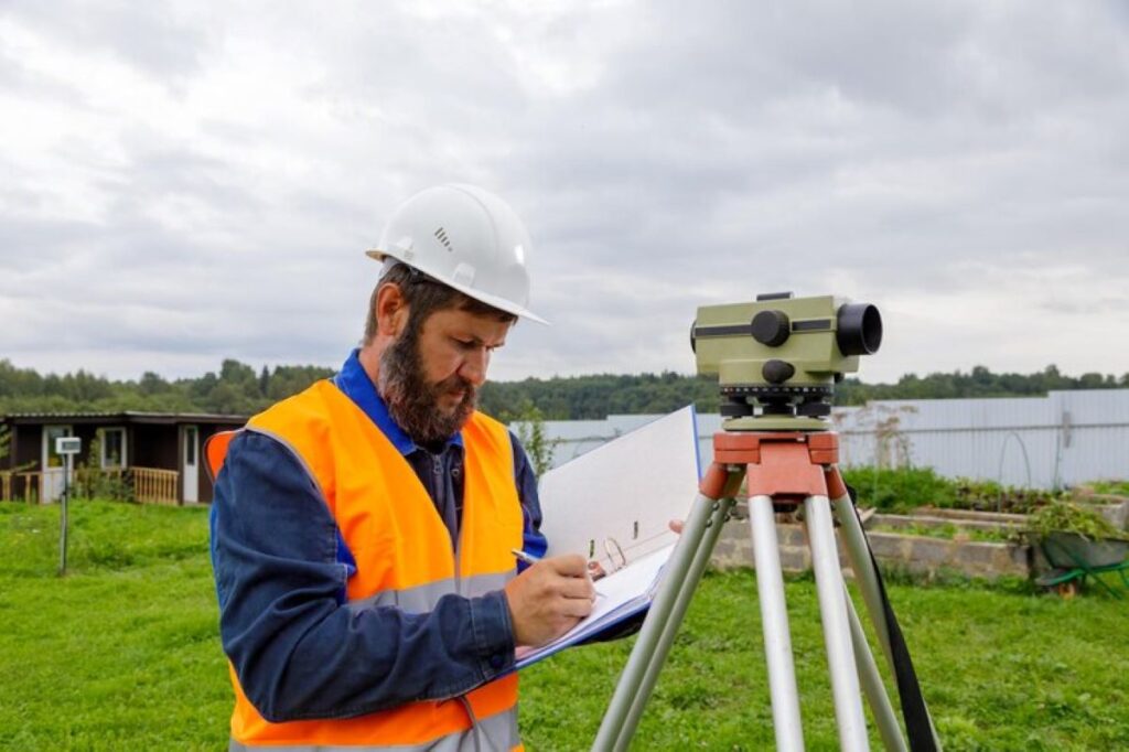
In the intricate world of property development and construction, the role of a land surveyor is both pivotal and multifaceted. Land surveyors provide the foundational data and insights necessary for successful project planning and execution. Their expertise ensures that developments are built on solid ground, both literally and figuratively, by offering precise measurements and assessments of land. This article delves into the various responsibilities and contributions of land surveyors in the realm of property development and construction, highlighting their indispensable role in shaping our built environment.
The Importance of Land Surveying in Property Development
Ensuring Accurate Land Measurements
One of the primary responsibilities of a land surveyor is to provide accurate measurements of land. This involves determining the precise boundaries of a property, which is crucial for avoiding disputes with neighbouring landowners. Accurate measurements also ensure that developers utilise the land efficiently, maximising the potential of the site while adhering to legal boundaries.
Land surveyors employ a range of sophisticated tools and technologies to achieve precise measurements. These include GPS systems, theodolites, and laser scanning equipment, which together enable surveyors to map out land with remarkable accuracy. This data forms the bedrock upon which architects and engineers can design and plan structures, ensuring that every aspect of the development is optimally aligned with the land’s characteristics.
Assessing Land Topography and Features
Beyond measuring boundaries, land surveyors are tasked with assessing the topography and natural features of a site. This includes identifying slopes, elevations, and any natural obstacles that might impact construction. Understanding the topography is essential for designing drainage systems, roads, and other infrastructure that must work harmoniously with the land’s natural contours.
Topographical surveys provide developers with a detailed map of the land’s surface, highlighting both opportunities and challenges. This information is crucial for making informed decisions about site layout, building orientation, and landscaping. By understanding the land’s natural features, developers can create designs that are not only functional but also environmentally sensitive.
Land Surveyors in the Construction Phase
Setting Out and Construction Staking
During the construction phase, land surveyors play a critical role in setting out the site. This process, known as construction staking, involves marking the exact locations where structures will be built. Surveyors translate the architect’s plans into physical markers on the ground, ensuring that construction teams have clear guidelines to follow.
Construction staking is vital for maintaining the integrity of the design and ensuring that the project adheres to regulatory requirements. By providing precise markers, surveyors help prevent costly errors and rework, which can arise from misalignments or incorrect placements of structures. This meticulous attention to detail ensures that the project progresses smoothly and efficiently.
Monitoring Construction Progress
Throughout the construction process, land surveyors continue to monitor the site to ensure that the work remains aligned with the original plans. This involves regular checks and measurements to verify that the construction is proceeding as intended. Any deviations from the plans can be quickly identified and addressed, minimising the risk of significant issues arising later on.
Surveyors also play a role in ensuring compliance with building codes and regulations. By providing ongoing assessments and documentation, they help construction teams adhere to legal and safety standards. This oversight is crucial for maintaining the quality and integrity of the project, ultimately contributing to the safety and longevity of the built environment.
Technological Advancements in Land Surveying
The Role of GPS and Laser Scanning
Technological advancements have revolutionised the field of land surveying, enhancing both accuracy and efficiency. GPS technology allows surveyors to pinpoint locations with incredible precision, reducing the time and effort required for traditional surveying methods. This technology is particularly useful for large or complex sites, where traditional methods might be impractical or time-consuming.
Laser scanning, or LiDAR, is another technological breakthrough that has transformed land surveying. By emitting laser beams and measuring the time it takes for them to return, surveyors can create detailed 3D models of the land. These models provide a comprehensive view of the site, capturing even the most minute details. This level of detail is invaluable for planning and design, offering insights that were previously unattainable.

Integration with Building Information Modelling (BIM)
Building Information Modelling (BIM) is an increasingly popular tool in the construction industry, offering a digital representation of a building’s physical and functional characteristics. Land surveyors play a crucial role in integrating their data with BIM, providing the accurate site information needed to create comprehensive models.
By incorporating survey data into BIM, developers and construction teams can visualise the entire project in a virtual environment. This integration facilitates better planning, coordination, and communication among all stakeholders, reducing the risk of errors and enhancing the overall efficiency of the project. The synergy between land surveying and BIM represents a significant advancement in the way construction projects are conceived and executed.
Challenges Faced by Land Surveyors
Dealing with Complex Terrain
Surveying land is not without its challenges, particularly when dealing with complex or difficult terrain. Rugged landscapes, dense vegetation, and urban environments can pose significant obstacles to obtaining accurate measurements. Surveyors must employ a combination of skill, experience, and technology to navigate these challenges and deliver reliable data.
In such situations, surveyors may need to adapt their methods, using specialised equipment or techniques to overcome the difficulties presented by the terrain. This adaptability is a testament to the expertise and problem-solving abilities of land surveyors, who must often think creatively to achieve their objectives.
Navigating Legal and Regulatory Requirements
Land surveyors must also navigate a complex web of legal and regulatory requirements. Each project is subject to a myriad of laws and standards, ranging from zoning regulations to environmental protections. Surveyors must ensure that their work complies with these requirements, providing the necessary documentation and evidence to support the project’s legal standing.
This aspect of the job requires a thorough understanding of local, regional, and national regulations, as well as the ability to communicate effectively with regulatory bodies. By ensuring compliance, surveyors help protect developers from legal disputes and potential fines, safeguarding the project’s viability and success. Learn more about what to expect when working with a professional surveyor.
The Future of Land Surveying in Construction
Embracing New Technologies
The future of land surveying in construction is poised to be shaped by continued technological advancements. Emerging technologies such as drones and artificial intelligence are set to further enhance the capabilities of surveyors, offering new ways to collect and analyse data. Drones, for example, can provide aerial surveys of sites, capturing data that might be difficult or dangerous to obtain from the ground.
Artificial intelligence can assist in processing and interpreting the vast amounts of data collected during surveys, identifying patterns and insights that might otherwise go unnoticed. By embracing these technologies, land surveyors can continue to improve the accuracy, efficiency, and scope of their work, driving innovation in the construction industry.

Increasing Collaboration and Integration
As the construction industry becomes more interconnected, the role of land surveyors is likely to become increasingly collaborative. Surveyors will work more closely with architects, engineers, and other stakeholders to ensure that projects are designed and executed with precision and foresight. This collaboration will be facilitated by digital platforms and tools that enable seamless communication and data sharing.
The integration of survey data with other aspects of project planning and management will lead to more cohesive and efficient workflows, reducing the potential for errors and enhancing the overall quality of construction projects. As a result, land surveyors will continue to be indispensable partners in the development and construction process, contributing their expertise to the creation of safe, sustainable, and innovative built environments.

Leave a Reply