
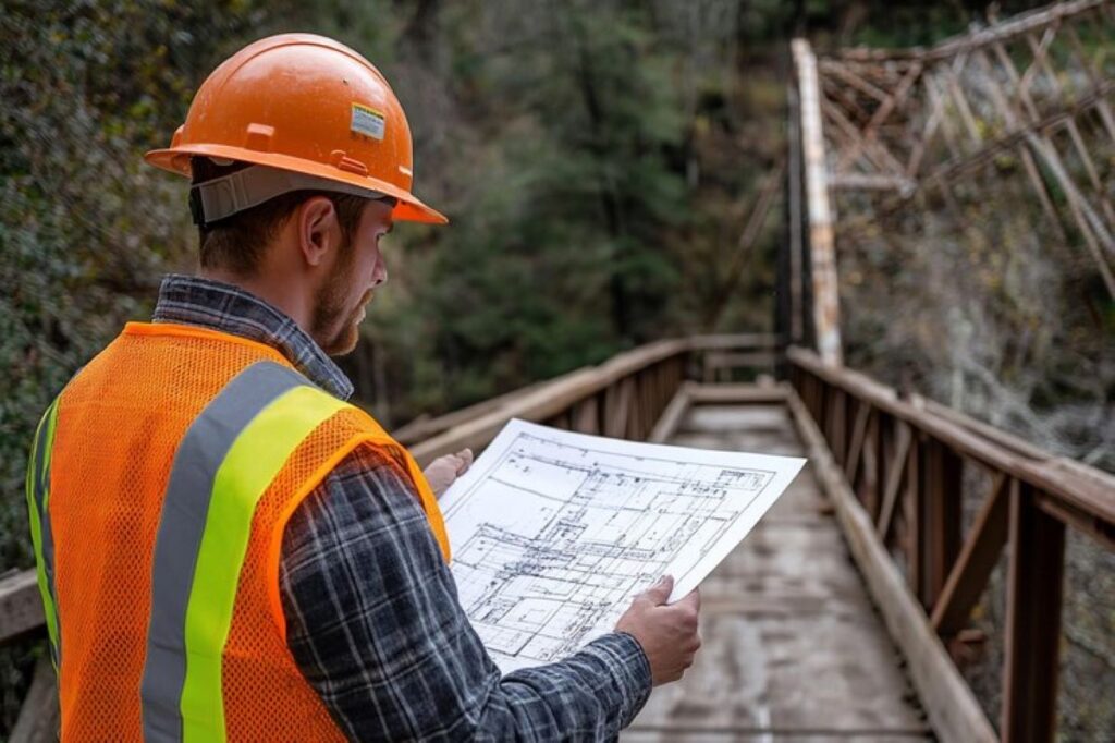
Understanding Easement Plan and Contour Surveys
Easement plans and contour surveys are essential tools in modern land development and property management. These specialised surveys provide crucial information for property owners, developers, and construction professionals.
What are Easement Plans?
Easement Plan represent legal rights granted to entities for specific uses of private property. These plans detail:
- Access routes across private land
- Utility corridors for power lines or water pipes
- Rights-of-way for public infrastructure
- Drainage easements for water management
What are Contour Surveys?
Contour Surveys create detailed topographical maps showing land elevation changes and natural features. These surveys capture:
- Ground surface elevations
- Slopes and gradients
- Natural drainage patterns
- Existing site features
The Role of Expert Surveyors
Expert surveyors utilise advanced technology and precise measurement techniques to create accurate representations of land characteristics. Their expertise ensures:
- Compliance with local regulations
- Precise boundary definitions
- Accurate elevation data
- Detailed documentation of existing site conditions
The Value of Professional Surveying
The value of professional surveying extends beyond basic measurements. Expert surveyors interpret complex data, identify potential challenges, and provide solutions for land development projects. Their knowledge proves invaluable in:
- Planning construction projects
- Managing drainage systems
- Designing infrastructure
- Resolving property disputes
Maintaining Accuracy Standards
Professional surveyors maintain strict accuracy standards through:
- State-of-the-art equipment calibration
- Regular quality control checks
- Adherence to industry best practices
- Detailed documentation procedures
These comprehensive surveys form the foundation for successful land development projects, ensuring informed decision-making and efficient project execution.
The Role of Expert Surveyors in Property and Infrastructure Projects
Expert surveyors deliver comprehensive services essential for successful property and infrastructure development. Registered surveyors provide specialised end-to-end solutions, including:
- Detailed site assessments and measurements
- Property boundary determinations
- Infrastructure planning support
- Construction layout services
- As-built documentation
Utility Locators bring critical expertise to construction projects through:
- Underground utility detection and mapping
- Non-destructive digging services
- 3D utility mapping
- Risk mitigation strategies
- Compliance documentation
The Wumara Group stands out in the NSW and QLD markets with its integrated approach to surveying and infrastructure services. Their site investigation project management encompasses:
- Comprehensive site analysis
- Environmental impact assessments
- Cultural heritage considerations
- Stakeholder engagement
A distinguishing feature of Wumara Group’s service offering is their Indigenous procurement consulting expertise, supporting major project tendering across various sectors:
- Telecommunications projects (CI International, Telstra, NBN)
- Government infrastructure (School Infrastructure NSW)
- Local council developments (City of Sydney Council)
Their proven track record in handling complex projects stems from combining technical excellence with cultural awareness. This unique approach has earned them recognition for:
- Responsive project management
- High-quality deliverables
- Cost-effective solutions
- Cultural sensitivity in project execution
The integration of traditional surveying expertise with modern technology and cultural understanding positions expert surveyors as invaluable partners in property and infrastructure development.
Specialized Services Provided by Expert Surveyors
Expert surveyors conduct detailed easement surveys to establish and document legal rights associated with land use. These surveys serve as critical tools in determining specific access rights, restrictions, and privileges granted to entities other than the property owner.
Key Components of Easement Surveys:
- Right of Way Assessments: Identification of designated paths or corridors for utilities, pedestrians, or vehicles
- Utility Easements: Documentation of areas reserved for power lines, water mains, or telecommunications infrastructure
- Conservation Easements: Mapping of protected natural areas or heritage sites
Professional surveyors employ advanced mapping techniques to create precise easement documentation. These methods include:
- GPS technology for accurate coordinate recording
- Digital mapping software for detailed plan creation
- Ground-penetrating radar for subsurface utility detection
- Laser scanning for high-precision measurements
The mapping process involves several technical steps:
- Initial site reconnaissance and research of existing records
- Field measurements and data collection
- Digital data processing and analysis
- Creation of detailed easement plans and documentation
Accurate easement surveys protect property owners and stakeholders by:
- Preventing boundary disputes
- Ensuring compliance with local regulations
- Facilitating proper land development planning
- Safeguarding legal rights and responsibilities
Expert surveyors utilise specialised equipment and software to generate comprehensive easement plans. These plans include detailed information about:
- Easement boundaries and dimensions
- Permitted uses and restrictions
- Access points and maintenance requirements
- Relationship to existing property features
The Importance of Accurate Contour Surveys in Construction Projects
Contour surveys are vital tools in construction projects. They provide detailed representations of changes in land elevation and surface features. These surveys produce precise measurements of terrain variations, allowing project teams to visualise the natural landscape using contour lines drawn at specific vertical intervals.
Key Functions of Contour Surveys:
- Identifying steep slopes and potential drainage patterns
- Detecting natural barriers or obstacles
- Assessing earthwork requirements
- Determining optimal building placement
- Analysing site accessibility
The data collected from contour surveys directly influences important construction decisions. Project managers depend on these surveys to:
- Calculate cut-and-fill volumes for earthwork operations
- Design effective drainage systems
- Position structures to minimise environmental impact
- Plan efficient access routes for construction vehicles
- Develop erosion control strategies
Site Planning Applications:
Accurate contour data allows architects and engineers to create designs that seamlessly integrate with the natural terrain. This approach helps:
- Reduce construction costs by making the best use of the site
- Minimise disruption to the environment
- Create sustainable solutions for managing water runoff
- Ensure stability in structures built on varying landscapes
- Comply with local regulations regarding land development
The accuracy of modern surveying equipment enables detailed mapping of subtle changes in terrain. Professional surveyors employ advanced technologies like GPS systems and 3D laser scanning to capture high-resolution topographic data. This level of detail is invaluable during the design phase, as it helps teams anticipate potential challenges and devise effective solutions before construction begins.
Additional Services Offered by Expert Surveyors for Comprehensive Project Support
Expert surveyors provide essential boundary identification services to resolve property disputes between neighbouring landowners. These surveys establish precise property boundaries through:
- Historical document analysis
- Physical marker identification
- GPS coordinate verification
- Existing survey plan examination
When Boundary Identification Surveys Are Useful
Boundary identification surveys prove invaluable when:
- Erecting new fences
- Planning property extensions
- Resolving encroachment issues
- Selling or purchasing land
The creation of subdivision plans represents another critical service offered by expert surveyors. These detailed plans enable property owners to divide land parcels for development while adhering to local council regulations. A comprehensive subdivision plan includes:
- Lot dimensions and areas
- Access points and roads
- Utility connections
- Easement locations
- Environmental considerations
How Expert Surveyors Assist Developers in the Subdivision Process
Expert surveyors assist developers through the complex subdivision process by:
- Conducting initial site assessments
- Preparing documentation for council approval
- Setting out lot boundaries
- Creating final subdivision certificates
These specialised services support informed zoning decisions and ensure compliance with local development controls. Professional surveyors work closely with councils, architects, and developers to optimise land use potential while maintaining regulatory requirements.
The expertise of professional surveyors in boundary identification and subdivision planning proves essential for successful property development projects across NSW and QLD markets. Click here to get more about Surveying Companies Sydney: Combining Land and Utility Surveys.
Ensuring Quality, Legal Compliance, and Customer Satisfaction in Surveying Services
Professional surveying services demand unwavering commitment to quality standards and legal compliance. Expert surveyors implement rigorous quality control measures throughout each project phase:
Calibration and Testing
- Regular equipment calibration
- Systematic data verification
- Multiple measurement cross-checks

Documentation and Record-Keeping
- Detailed field notes
- Digital data backups
- Comprehensive project archives
Expert surveyors maintain strict adherence to regulatory requirements and industry standards, including:
- Local council regulations
- State planning guidelines
- National surveying standards
- Environmental protection laws
The delivery of high-quality surveying services relies on:
“Precision, accuracy, and attention to detail are non-negotiable elements in professional surveying work”
Quality Assurance Protocols:
- Independent peer reviews
- Regular staff training
- Advanced technology integration
- Standardised procedures
Professional surveyors protect client interests through:
- Professional indemnity insurance
- Clear communication channels
- Transparent pricing structures
- Detailed project documentation
Expert surveying firms like Wumara Group demonstrate their commitment to excellence through:
- ISO certification compliance
- Industry association memberships
- Regular professional development
- Client satisfaction surveys
These comprehensive quality measures ensure accurate, reliable, and legally compliant surveying services that meet client expectations and industry standards.
Leave a Reply